Why Chennai drowns in water for every heavy rain?
Tuesday, November 9, 2021 • Tamil


Listen to article
--:-- / --:--
1x

This is a beta feature and we would love to hear your feedback?
Send us your feedback to audioarticles@vaarta.com
Send us your feedback to audioarticles@vaarta.com


The metropolitan city Chennai's population is increasing day by day and the requirement of an abode in the centre of a city has become an inevitable wish for many Chennaite. But we all know Chennai is a very small place with 100 times more population.
Chennai is locked in an inextricable battle with water. In the brutal summers, the city can’t get enough of it. And when it rains, the coastal metropolis of over four million people often finds itself inundated by too much of it. For decades now, floods have ravaged the city: From the six-day-long downpour that submerged Chennai in 1943 to the more recent floods in 2005, 2010, 2013, 2015 and now in 2021.
Some of it is entirely the fault of the city’s administration - rapid urbanisation, destruction of critical wetlands, inadequate infrastructure and the likes. But much of it is also the consequence of Chennai’s geography. The result of urbanisation has caused the shrinkage of many lakes, ponds and water bodies in Chennai.
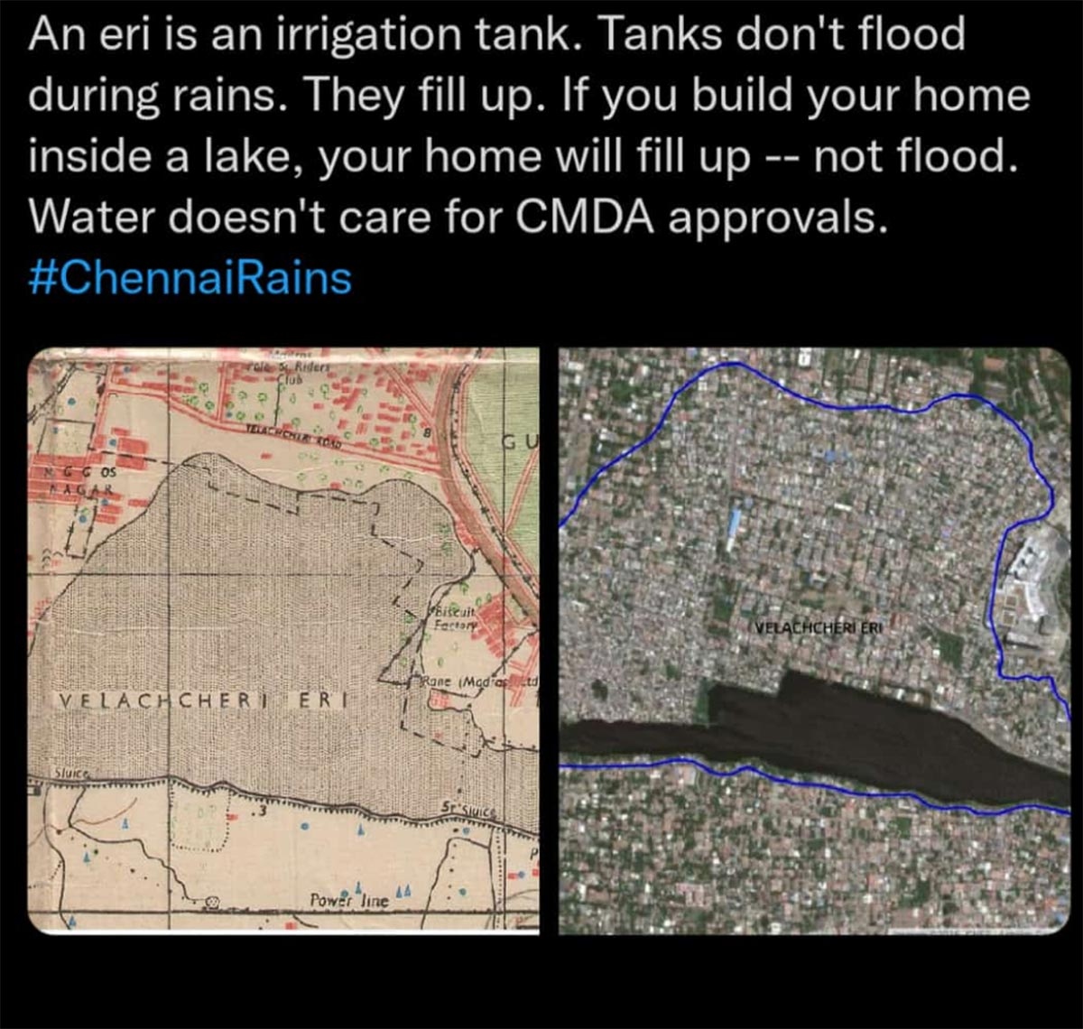
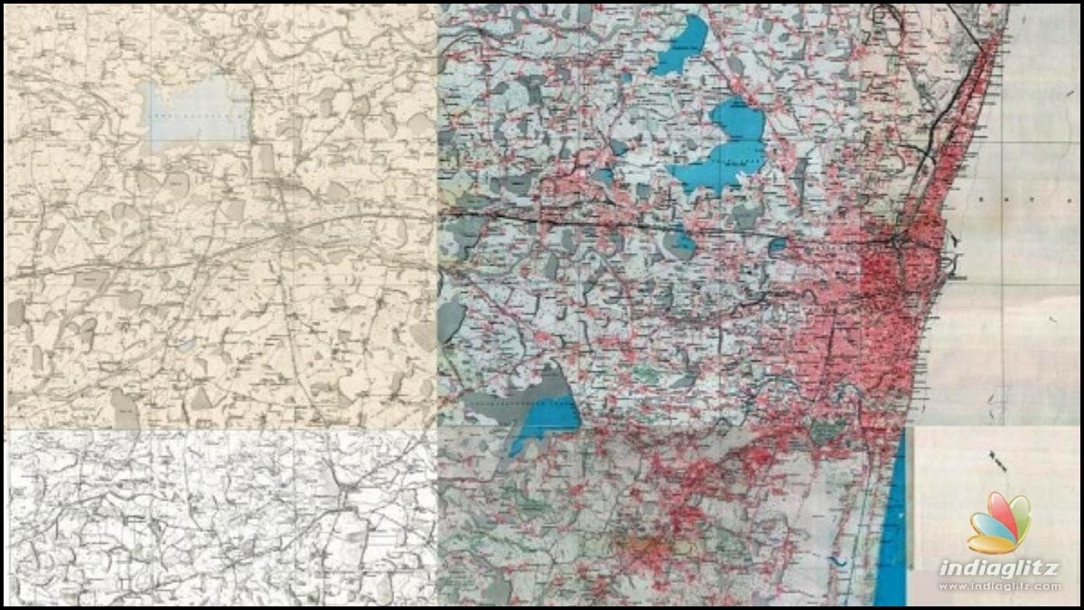
If we dig through the history of Chennai many localities are named after the presence of a water body. For example, Velach'ery', Rett'eri', Poth'eri', Ada'yar', Perun'galathur' and Kaattan'kulathur'. The suffix in these names denotes the waterbody which provided enough space for the water to get collected during heavy rains. These water bodies don't get flooded during rainy days, they fill up and collect the water which can be used for various other purposes. Urbanisation resulted in the shrinking of these water bodies and has now turned into construction sites, apartments and skyscrapers.
The above map shows the original size of Velachery lake and the present day scenario where the lake bed has now turned into buildings. Still, the city had some natural features that helped get the water out when the heavens opened. Apart from the Cooum and Adayar rivers, Chennai’s periphery once hosted a massive wetland, which provided a natural flood control barrier in the past.
The Cooum has now been reduced to a massive, stinking sewer (pdf) that snakes through the heart of the city, heaped with the waste generated by a heaving metropolis. Similarly, rampant encroachment and urbanisation in its upstream reaches have sapped the ability of the Adayar river to carry floodwater. Another key waterway, the Buckingham Canal, is also choked with silt and sewage. So, when Chennai floods, there aren’t enough unobstructed channels for the water to get out.
As per the latest reports, Chennai, along with 11 other districts, were affected by more than 30 cm of rainfall. The India Meteorological Department (IMD) has sounded a red alert in Tamil Nadu for the next three days, till Thursday (November 11). In its latest bulletin issued at noon on Tuesday, the IMD predicted “light to moderate rainfall at most places with heavy to very heavy rainfall and extremely heavy falls at isolated places” in the state
Follow us on Google News and stay updated with the latest!
 Follow


More News


Headlines