Has the low-pressure system moved from Chennai to Andhra?
Thursday, November 11, 2021 • Tamil


Listen to article
--:-- / --:--
1x

This is a beta feature and we would love to hear your feedback?
Send us your feedback to audioarticles@vaarta.com
Send us your feedback to audioarticles@vaarta.com


It is already known that the low-pressure depression that has formed in the Bay Of Bengal is now strengthened into a low-pressure system. According to earlier forecasts, the depression was expected to make landfall between Cuddalore and Sriharikota by 11 am of November 11. But the system has changed its path slightly and was expected to make landfall between Mahabalipuram-Sriharikota going by the forecasts on 10th November.
So it was announced that north coastal Tamil Nadu and Puducherry will receive extremely heavy rainfall to very heavy rainfall. The weather department had signalled a red alert as the rains may create floods. Last night, Tamil Nadu Weather Man updated that deadly bands of heavy rain spells may hit Chennai and the surroundings in the next 18 hours as the depression was about to make landfall.
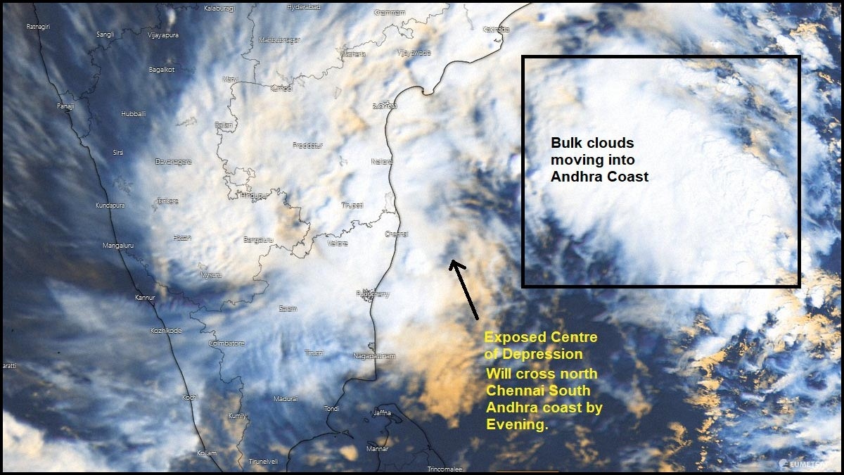
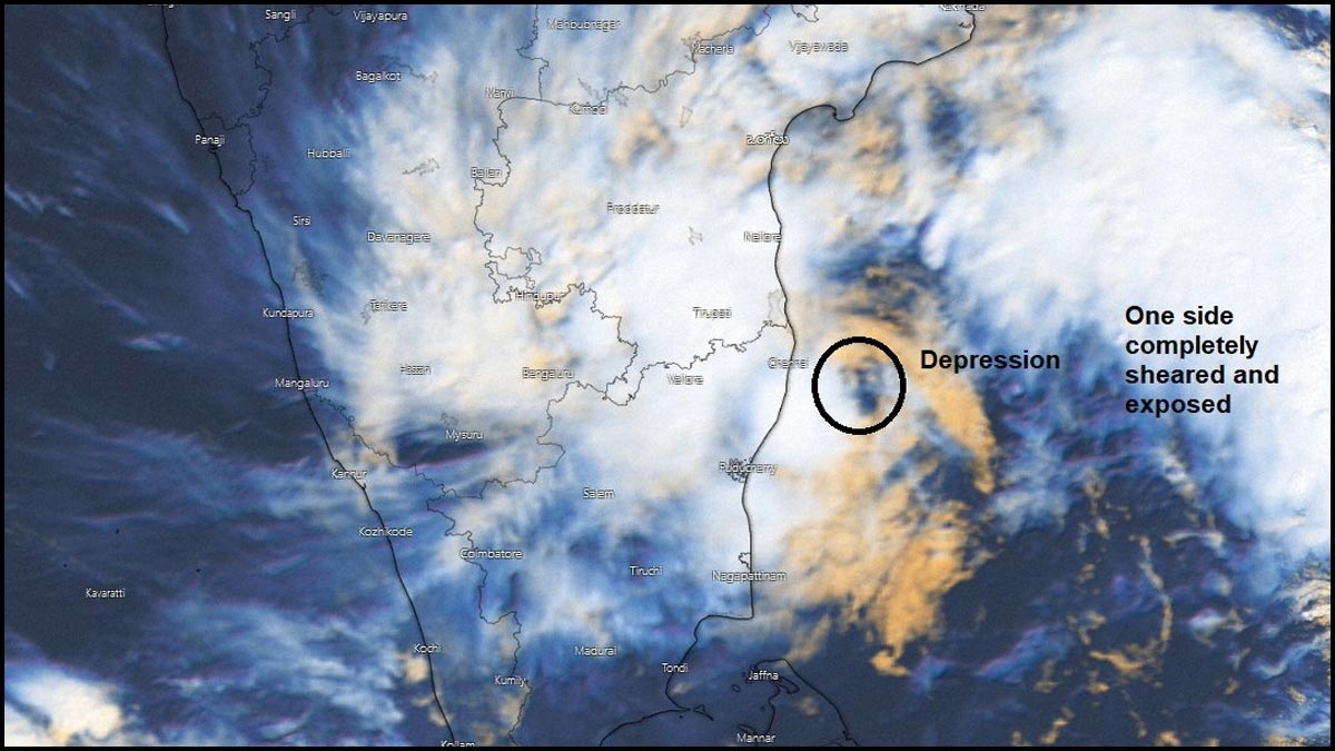
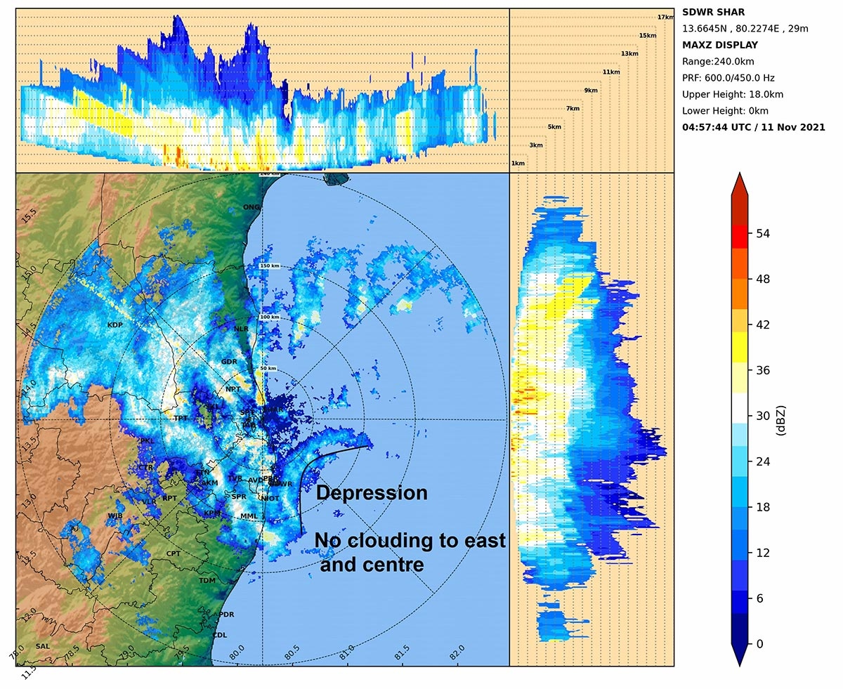
Now, the morning forecasts show that the low-pressure system has moved north further and the bulk clouds are moving to the Andhra coast. The exposed centre of the Depression will cross north Chennai and south Andhra coast by this evening. And the great news is that the worst rain spells are over and occasional rains will happen. It will be windy till Depression crosses the North Chennai-Sriharikota belt by evening.
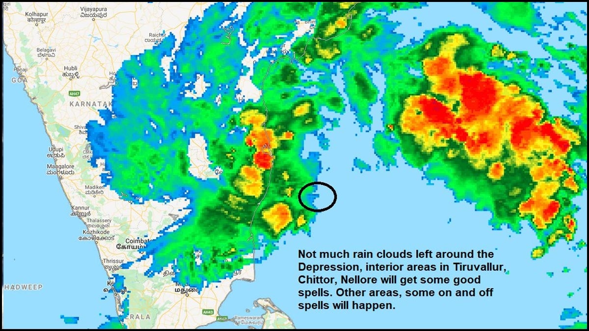
On average 150 mm rainfall was reported in Chennai and KTC belt and some stations 200 mm too. Also, the last band of clouds gave heavy farewell rains from the Depression. Heavy showers should decrease from now on. Meanwhile, the lakes' inflows and outflows are managed with cushion to the flood. Stay tuned for more updates.
Worst is over and occasional rains will happen. It will be windy till Depression crosses North Chennai-Sriharikota belt by evening. On average 150 mm rainfall reported in Chennai and KTC belt and some stations 200 mm too.
— Pradeep John (Tamil Nadu Weatherman) (@praddy06) November 11, 2021
Rainfall recorded lake inflows - https://t.co/WoUHUGXbJs pic.twitter.com/LQek7wtBd9
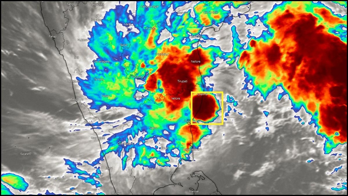
Last band of clouds giving heavy farewell rains from the Depression. Should last for another hour or so.
— Pradeep John (Tamil Nadu Weatherman) (@praddy06) November 11, 2021
Meanwhile the lakes inflows and outflows are managed with cushion to the flood. pic.twitter.com/Hc5K9Y6fBD
Follow us on Google News and stay updated with the latest!
 Follow


More News


Headlines